When I was planning my trip out west last year, I wasn’t sure whether a day trip to Grand Teton National Park was worth spending one fewer day in Yellowstone, so I inquired with a couple of friends, who told me that I should definitely see it. I decided to go for it, and I’m glad that I did. Grand Teton is a park filled with majestic mountain peaks and beautiful lakes. The photos below feature shots taken at Jenny Lake, Jackson Lake, and Snake River (site of one of Ansel Adams’ most famous photographs), as well as miscellaneous photos taken from around the park. My next post will highlight Grand Teton’s historic buildings, such as those located on Mormon Row.
Click on any photo to open a gallery.
Jackson Lake
Jackson Lake
Jackson Lake
Jackson Lake
Jackson Lake
Jackson Lake
View from the top of Signal Mountain.
View from the top of Signal Mountain.
Jenny Lake
Jenny Lake
Jenny Lake
Snake River. This is almost the exact same spot from where Ansel Adams took his famous photo.
These photos are from my visit to Mount Rushmore, including a drive along the scenic Iron Mountain Road. If you ever visit Mount Rushmore, I highly recommend first driving Iron Mountain Road from south to north. Complete with switchbacks, pigtail bridges, and single lane tunnels, it is a beautiful drive culminating in the final tunnel that frames Mount Rushmore as you drive through it. Along the way there are scenic lookouts, including one in which you can get your first look at Mount Rushmore from a distance across the valley.
As for Mount Rushmore itself, it is more impressive in person than photos would lead you to believe. It was late in the day by the time I got there so I only stayed long enough to take a few pics, though there is a hike around the monument if you have more time.
Click on any photo below to open a gallery.
A good look at the upper torso of Washington, which was never completed. The original intent was to carve all four presidents from head to waist.
Scenic lookout.
Scenic lookout.
My first view of Mount Rushmore in the distance from a scenic lookout on Iron Mountain Road.
Scenic lookout with Mount Rushmore visible in the distance (upper right).
The last tunnel on Iron Mountain Road beautifully frames Mount Rushmore.
The other end of this final tunnel on Iron Mountain Road frames Mount Rushmore.
These photos are from my drive along Needles Highway, a scenic, sometimes treacherous road winding through granite “needle” rock formations in the Black Hills of South Dakota. The road has a number of one-lane tunnels cut through the rock, wherein you have to be careful and make sure nobody is coming from the other direction before driving through them.
Needles Highway was the first leg of a grand loop scenic drive I took through Custer State Park that also included the Wildlife Loop and Iron Mountain Road before ending at Mount Rushmore. If you’re planning a trip to Rushmore, I highly recommend taking this loop if you have the time as the landscape is often spectacular.
Click on any photo below to open a gallery.
Needles Eye Rock
Looks like some sort of beast sitting at the top.
The final tunnel of the route when traveling north to south (single lane like the others).
Needles Eye Tunnel. All of the tunnels on this route are single lane, so you have to be careful when driving through.
These photos are from my ride on Timberline Lodge’s “Magic Mile” ski lift toward the summit of Mount Hood, a trip for which I was woefully under-dressed with just a windbreaker to protect me from the frigid winds. At the top I had a spectacular view of Mount Jefferson peeking above the clouds, as well as great looks at Timberline Lodge in the mist below. It’s definitely worth the ride if you’re visiting the lodge, or you can choose to hike up to the top. Had I had more time, I would have at least hiked back down from the top, but I needed to get back to Portland to catch my plane to Montana, so I rode both ways.
Click on any photo below to open a gallery.
This photo captures Timberline Lodge beneath a blanket of clouds with Mount Jefferson peeking through the top of the cloud cover.
I wonder if anyone was at the summit of Mount Jefferson looking across at us and enjoying a similar view of Mount Hood peeking above the clouds.
Like a beach meeting an ocean of clouds.
In this photo you can see skiers in the snow above the house.
One great aspect of Portland is its proximity to both mountains and beaches, either of which are just a day trip away. Although I didn’t have time to visit the Oregon coast on this trip, I did make the 90-minute drive up to Mount Hood, where I spent my final night in Oregon at Timberline Lodge near its summit. The lodge was made famous by The Shining (more on that in a later post). These photos are from my drive up to Mount Hood and my hikes around it.
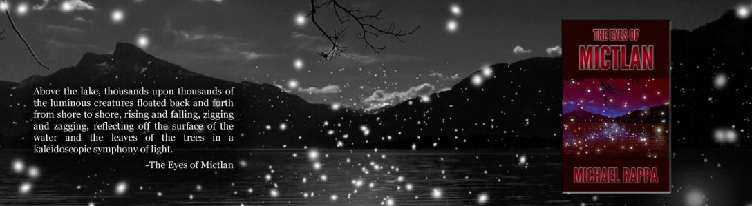
This is from my very first Eurotrip back in 2007, a photo of Lake Mondsee in Austria, originally shot in color on my old pocket cam and converted to black and white. Keen observers will note that a heavily photoshopped version of this photo appears on the cover of my novel.
Date: 4/1/2007 Camera: Panasonic DMC-FX8 Click for larger view
I thought it might be a neat exercise to hone my black-and-white conversion skills on some of my favorite older color photos that haven’t aged well (due to being shot with low-quality digital cameras). This is my first attempt, a photo taken during my foggy hike up to the top of Clingmans Dome in the North Carolina Smoky Mountains back in 2004.
Date: 7/4/2004 Camera: Fuji FinePix2650 Click for larger view
This was taken during my hike of the Skyline Trail in Cape Breton, Canada. It’s not a very vibrant photo due to the rainy conditions, but I like the imagery of a solitary figure standing at the top of a mountain gazing over the sea and the Cabot Trail. I didn’t have time to complete the entire trail myself, but had I done so, I would have been standing in the same spot as the person in this photo.
Date: 9/2/2016 Camera: Nikon D5100 Click for larger view
Here is a compilation of panoramas and HDR photos taken during my two-week road trip through the Canadian Maritime Provinces in late August/early September, 2016.
All of the following photos are panoramas except where HDR appears in the description.
Prince Edward Island
We only allotted two days for Prince Edward Island but it ended up being one of our favorite legs of the trip. We stayed on the less-touristy northeast side of the island at an inn on a cliff overlooking the sea. The view from our room was spectacular. The entire stay was relaxing and serene. I only wish we could have spent more time here.
View of a sunset from our inn.View from beneath the cliff on which our inn was situated.Same sunset as above, this one in HDR. The effect was almost like a painting.
Cape Breton, Nova Scotia
Cape Breton is an island at the northeastern tip of Nova Scotia. It is a must-visit if you’re in the area. The Cabot Trail, which encircles the majority of the island, is a drive of breathtaking beauty. The highlands, in particular, are reminiscent of Scotland. In all, we spent four days here but with all of the hiking and sightseeing available, you could easily stay a week or two.
Our view after hiking to the top of Franey Mountain.View from our cabin at the Glenora Inn, where we stayed one night.
New Brunswick
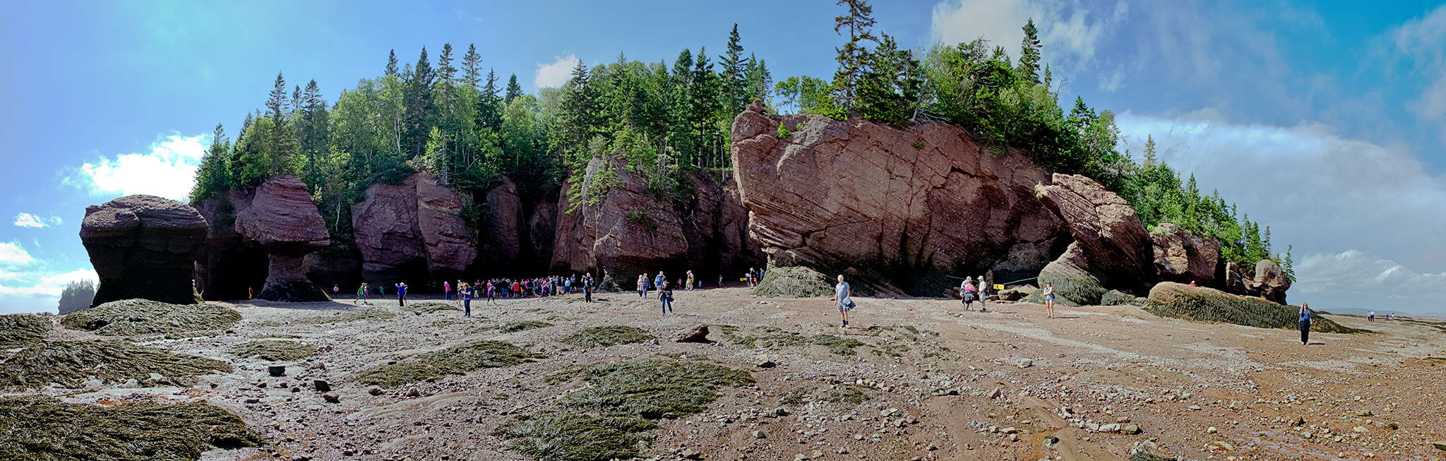
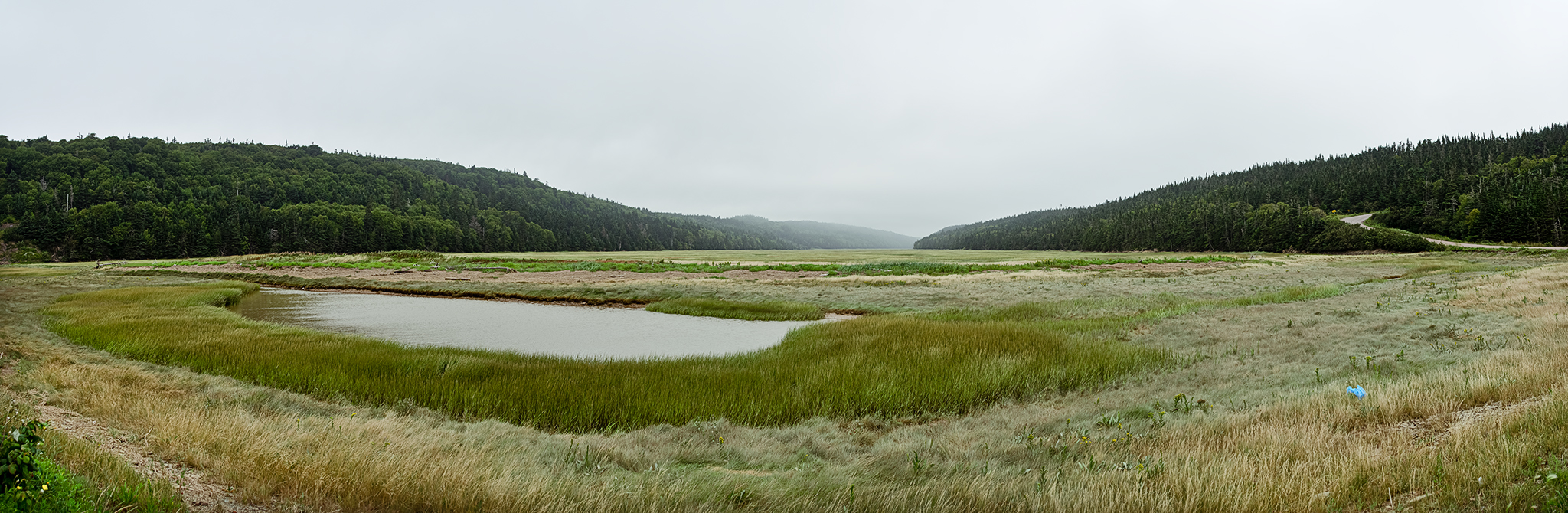
The New Brunswick area has much to offer, including Fundy National Park, which we barely had time to explore outside of one early evening hike. We spent most of our two days in this province at Cape Enrage and the Hopewell rocks–where you can walk the beach at low tide and kayak around the same rocks at high tide. There are no high-tide photos in this collection, but I did take some and will share them at a later date.
Hopewell RocksHopewell Rocks (HDR)Hopewell RocksHopewell Rocks (HDR)The grassy area across from the beach near Cape Enrage.The beach beneath Cape Enrage.
Nova Scotia
I didn’t take many panoramas during my stay on the main island of Nova Scotia, so there isn’t much represented here. The highlights from this leg of the trip included a two-night stay in the charming capital city of Halifax and a stop in the lovely town of Lunenberg, where we also visited The Ovens National Park. Nova Scotia has so much more worth seeing but a lot of our time on the island was spent driving to and from Cape Breton.
Looking out to the sea from the foggy rocks beneath the Cape Forchu lighthouse.View from inside one of the sea caves at The Ovens National Park.
Overall, it was a great trip that gave us a taste of everything the Canadian Maritimes have to offer, though we could easily have spent a week or more at any one of the four primary regions we visited. We fell so much in love with the area, in fact, that we are giving serious thought to exploring the possibility of moving there.
When hiking to the top of Franey Mountain in the Cape Breton Highlands, you will encounter this picturesque lookout about 1/3 of the way up (or 2/3 of the way down, depending on which of the two trails you chose to go up). It’s a beautiful hike, especially as you get closer to the top, where you are rewarded with spectacular views of the mountains and coast. The 1,100-foot ascent is not too challenging (especially if an out-of-shape schlub like me can make it to the top)–I think it took us between 2 1/2 and 3 hours to get to the top, though it can be done more quickly if you’re in better shape and not stopping for photos. Going down was much faster as we took the second trail down, which was much less interesting from a scenery perspective, and also less challenging.
I made one alteration to this photo–I used the content-aware touchup tool in Camera Raw to remove my hiking pole that was leaning against the rock–it turned out really well, not even noticeable. Bonus points if you can tell me where the pole was. 🙂
Date: 9/3/2016 Camera: Nikon D5100 Click for larger view